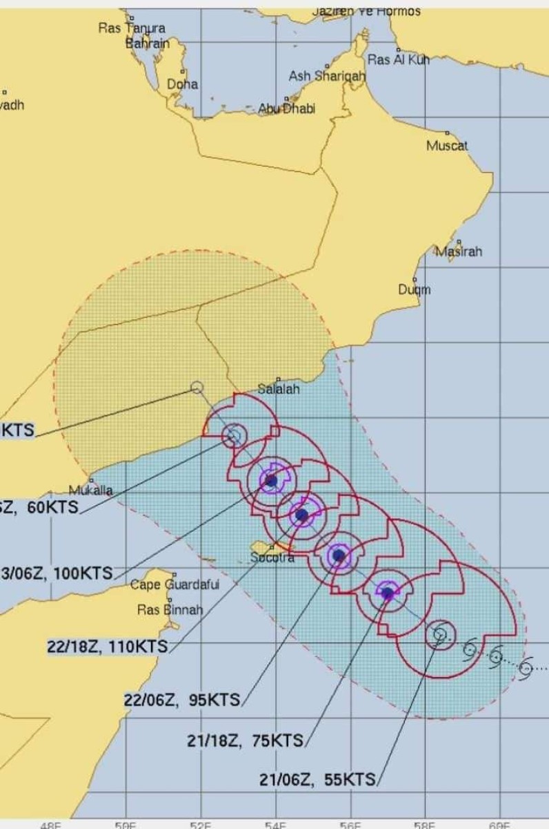
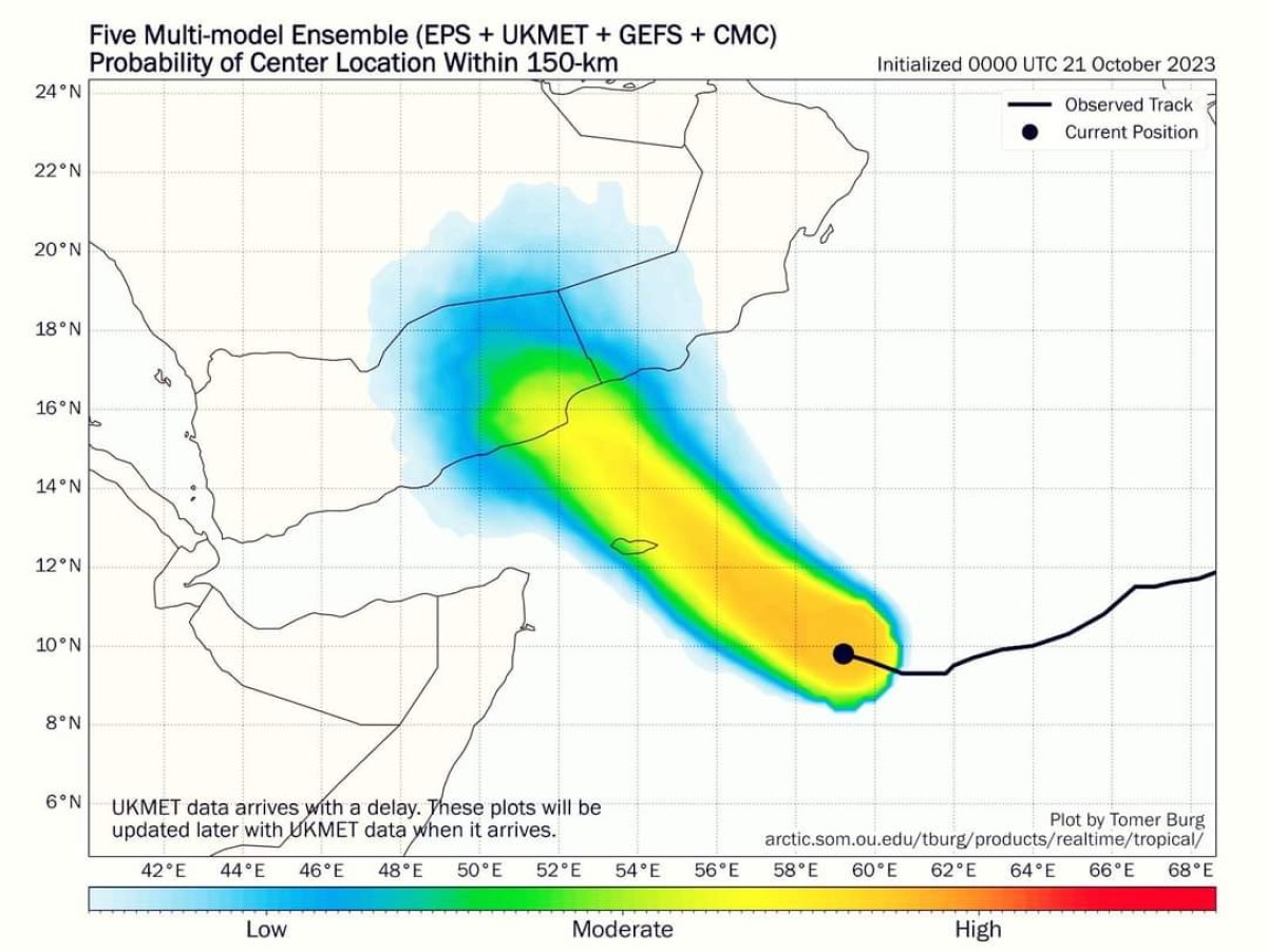
Meteorology warns that Cyclone #Tej will continue to develop, expecting heavy rains on Socotra


The National Center for Meteorology, Early Warning and Warning said that satellite images and weather maps show that the cyclonic storm “Tej” continues to develop in the southern Arabian Sea, 550 km from the Socotra Archipelago and about 990 km from the coast of Al-Mahra Governorate, south-eastern Yemen.
According to the Meteorological Center, the storm is moving at a speed of 20 km per hour towards the west and northwest in the Indian Ocean towards the Yemeni Governorate of Al-Mahra and Dhofar in Oman, where the weather appears cloudy with heavy to very heavy rains expected, accompanied by thunderstorms on the Socotra Archipelago and the eastern and southern territorial waters. The eastern part of the Arabian Sea and the Gulf of Aden.
The center also expected that the coming hours would witness stormy winds ranging between 40 to 50 knots and gusts exceeding 60 knots.
The center warned citizens of the Socotra Archipelago not to be in flood channels and valleys.
He warned ship captains and fishermen against sailing in areas affected by the dangerous weather condition, noting that the sea is very turbulent to high and very high waves near the center of the storm, with heights ranging between 4 and 7 metres.
He also called on the relevant official authorities to take the necessary measures and measures to protect lives and property.
In addition, the National Early Warning Center in the Sultanate of Oman indicated chances of the tropical storm developing into a first-class hurricane within the next 24 hours.
It is expected that the direct impact on the governorates of Dhofar and Al Wusta will begin on the evening of Sunday, October 22, and the possibility of crossing the center of the tropical situation on Tuesday morning between the governorates of Dhofar in Oman and Al Mahra in Yemen.
